Our Digital Culture: Hunting for the World’s Strangest Features on Google Maps (video)

Share
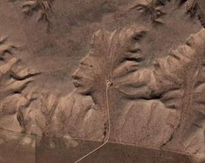
Google Earth lets you see the surface of the world in remarkable detail. Turns out there was a lot hiding out there. Since its release in 2005, Google Earth has been fueling a sort of online scavenger hunt to find weird, strange, or disturbing images caught by the aerial photography used to construct the map. There are mountains that look like Indian faces, crop circles, mile-long line art - you name it, it's probably been found. As people located more anthropomorphic geography, or human artwork writ large, they started listing them on forums, creating websites around hunting for them, and composing compilations. You can see one of the most extensive such collections in the video below. I expected most of this fascination with Google Earth seek-and-find to slowly die off, but the phenomenon still seems to be going strong five years later. What is it about these geo-oddities that we find so captivating?
The following tour of strange places on Google Earth is one of the more extensive I've found. Yet it is far from being alone. There are thousands of these videos on YouTube, many with overlapping lists. Some may be more to your liking. I prefer this particular video because it displays the latitude and longitude of each site so you can find them on your own later.
The hunt for geo-oddities has only expanded since Google Earth became more widely available in browsers in 2008, and I think it will continue to grow as digital maps become more sophisticated. As I've mentioned before, the future of maps will include more detailed 3D images that cover the world in even greater detail. We'll have more visual space for hunters to explore, and these maps will be updated more regularly to keep them current.
Be Part of the Future
Sign up to receive top stories about groundbreaking technologies and visionary thinkers from SingularityHub.


At some point won't all the geo-oddities be found? Probably not. Sure, major geological features like the 'Indian head' near the border between Alberta and Saskatchewan in Canada are probably going to be cataloged fairly well. Yet a good number of geo-oddities are artificial. They're petroforms, crop circles, or buildings that people have purposefully constructed with a sky-high point of view in mind. I imagine that such artwork catering to aerial photography is only going to increase as maps like Google Earth continue to rise in prominence.
And there's a whole other branch of image-hunting that we haven't mentioned yet. The search for strange and unusual sights on Google Map's Street View. There are thousands of lists of oddities there as well. A pair of legs walking on their own, kids floating in air, cows with too many limbs - probably all artifacts of the photographic stitching, but still interesting to those who peruse the archives of Street View. Lifelogging and geo-tagging are going to exponentially increase the number of such artifacts caught on camera. Not to mention the embarrassing or weird candid moments. Everyone loves to see someone acting silly - and now there are going to be millions of such images easily browsed via digital maps. Publicly accessible images will provide a seemingly infinite realm of exploration for those who love to find strange features in the mundane.
The hunt for geo-oddities is a strange consequence of the modern age, but not an unpleasant one. I look forward to seeing what other new pursuits we create as our civilization is exposed to an ever increasing flood of digital information. Are we going to seek out weird patterns in bacterial DNA? Listen for snips of popular songs in the sounds of cosmic background radiation? Make poetry from randomly selected tweets? ...Yeah, we probably will.
[image credit: Google Earth]
[video credit: ntorgov]
Related Articles

This Brain Pattern Could Signal the Moment Consciousness Slips Away

This Week’s Awesome Tech Stories From Around the Web (Through February 14)

Vast ‘Blobs’ of Rock Have Stabilized Earth’s Magnetic Field for Hundreds of Millions of Years
What we’re reading
