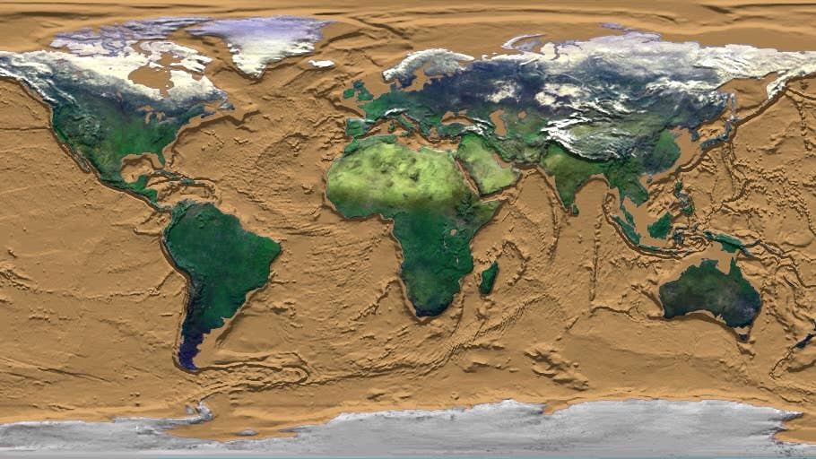
Witness 1.8 Billion Years of Earth’s Tectonic Dance in a New Animation

Share
Using information from inside the rocks on Earth’s surface, my colleagues and I have reconstructed the plate tectonics of the planet over the last 1.8 billion years.
It is the first time Earth’s geological record has been used like this, looking so far back in time. This has enabled us to make an attempt at mapping the planet over the last 40 percent of its history, which you can see in the animation below.
The work, led by Xianzhi Cao from the Ocean University in China, was recently published in the open-access journal Geoscience Frontiers.
A Beautiful Dance
Mapping our planet through its long history creates a beautiful continental dance—mesmerizing in itself and a work of natural art.
It starts with the map of the world familiar to everyone. Then India rapidly moves south, followed by parts of Southeast Asia as the past continent of Gondwana forms in the Southern Hemisphere.
Around 200 million years ago (Ma or mega-annum in the reconstruction), when the dinosaurs walked the earth, Gondwana linked with North America, Europe, and northern Asia to form a large supercontinent called Pangaea.
Then, the reconstruction carries on back through time. Pangaea and Gondwana were themselves formed from older plate collisions. As time rolls back, an earlier supercontinent called Rodinia appears. It doesn’t stop here. Rodinia, in turn, is formed by the breakup of an even older supercontinent called Nuna about 1.35 billion years ago.
Why Map Earth’s Past?
Among the planets in the solar system, Earth is unique for having plate tectonics. Its rocky surface is split into fragments (plates) that grind into each other and create mountains or split away and form chasms that are then filled with oceans.
Apart from causing earthquakes and volcanoes, plate tectonics also pushes up rocks from the deep earth into the heights of mountain ranges. This way, elements which were far underground can erode from the rocks and wash into rivers and oceans. From there, living things can make use of these elements.
Among these essential elements is phosphorus, which forms the framework of DNA molecules, and molybdenum, which is used by organisms to strip nitrogen out of the atmosphere and make proteins and amino acids—building blocks of life.
Plate tectonics also exposes rocks that react with carbon dioxide in the atmosphere. Rocks locking up carbon dioxide is the main control on Earth’s climate over long time scales—much, much longer than the tumultuous climate change we are responsible for today.
A Tool for Understanding Deep Time
Mapping the past plate tectonics of the planet is the first stage in being able to build a complete digital model of Earth through its history.
Such a model will allow us to test hypotheses about Earth’s past. For example, why Earth’s climate has gone through extreme “Snowball Earth” fluctuations or why oxygen built up in the atmosphere when it did.
Be Part of the Future
Sign up to receive top stories about groundbreaking technologies and visionary thinkers from SingularityHub.


Indeed, it will allow us to much better understand the feedback between the deep planet and the surface systems of Earth that support life as we know it.
So Much More to Learn
Modeling our planet’s past is essential if we’re to understand how nutrients became available to power evolution. The first evidence for complex cells with nuclei—like all animal and plant cells—dates to 1.65 billion years ago.
This is near the start of this reconstruction and close to the time the supercontinent Nuna formed. We aim to test whether the mountains that grew at the time of Nuna formation may have provided the elements to power complex cell evolution.
Much of Earth’s life photosynthesizes and liberates oxygen. This links plate tectonics with the chemistry of the atmosphere, and some of that oxygen dissolves into the oceans. In turn, a number of critical metals—like copper and cobalt—are more soluble in oxygen-rich water. In certain conditions, these metals are then precipitated out of the solution: In short, they form ore deposits.
Many metals form in the roots of volcanoes that occur along plate margins. By reconstructing where ancient plate boundaries lay through time, we can better understand the tectonic geography of the world and assist mineral explorers in finding ancient metal-rich rocks now buried under much younger mountains.
In this time of exploration of other worlds in the solar system and beyond, it is worth remembering there’s so much about our own planet we are only just beginning to glimpse.
There are 4.6 billion years of it to investigate, and the rocks we walk on contain the evidence for how Earth has changed over this time.
This first attempt at mapping the last 1.8 billion years of Earth’s history is a leap forward in the scientific grand challenge to map our world. But it is just that—a first attempt. The next years will see considerable improvement from the starting point we have now made.
The author would like to acknowledge this research was largely done by Xianzhi Cao, Sergei Pisarevsky, Nicolas Flament, Derrick Hasterok, Dietmar Muller and Sanzhong Li; as a co-author, he is just one cog in the research network. The author also acknowledges the many students and researchers from the Tectonics and Earth Systems Group at The University of Adelaide and national and international colleagues who did the fundamental geological work this research is based on.
This article is republished from The Conversation under a Creative Commons license. Read the original article.
Image Credit: NASA/Goddard Space Flight Center Scientific Visualization Studio
Alan Collins is a professor of geology at the University of Adelaide. He works on a wide variety of projects dealing with how the planet has operated over the 4.6 billion years of its history. Much of the research he works on with PhD students is about mapping the ancient plate tectonics of the planet. Where were continents in the past? Where were the subduction zones, the mid-ocean ridges? This is not a straightforward question in the really ancient Earth because we have lost all the oceanic crust older than about 200 million years old. Before that, we need to use more subtle proxies for the existence of now long-defunct plate margins.
Related Articles

Are Animals and AI Conscious? Scientists Devise New Theories for How to Test This

These Brain Implants Are Smaller Than Cells and Can Be Injected Into Veins

This Wireless Brain Implant Is Smaller Than a Grain of Salt
What we’re reading
