As organizations increasingly look to employ drones for everything from deliveries to pest control to surveillance, safety in the skies is becoming an issue that demands more attention. Regulations around drones and their flight vary widely between countries and regions, but to really start scaling the technology there will need to be more standardization in terms of who can fly where, how fast, how high, etc.
The UK is taking the lead on drone mobility, with an announcement this week of plans to build a 165-mile (265 kilometer) “drone superhighway.” Project Skyway is being led by Altitude Angel, a UK aerospace and unified traffic management company, and involves a consortium of other stakeholders, including British Telecommunications Group.
So how do you build a highway in the air? Picture a corridor of airspace running between various cities, with drones zooming back and forth in the designated segments of sky. The differentiating factor here is that rather than each drone using its own onboard sensors to navigate the route, they all tap into a ground-based network of sensors. This network brings together data from multiple sources to create a real-time, high-resolution moving map of the airspace and guides drones to their destinations.
By shedding their onboard sensors, the drones using the superhighway would free up space and weight capacity to increase their payloads and, hopefully, their efficiency.
Project Skyway could also help democratize drone use and access to airspace; as the company’s press release put it, “This system will ensure any company can safely get airborne and build a scalable drone solution to benefit society, businesses, and industry, on level and fair terms, accessible to everyone.” How much it will cost companies to use the highway hasn’t been disclosed yet, though.
Oxford will be the superhighway’s central node, connecting airspace above Coventry and Rugby to the north, Cambridge to the east, Milton Keynes to the south. The network could eventually be expanded to additional cities including Southampton and Bentwaters.
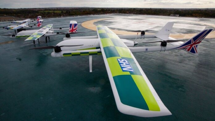
Several different types of organizations are looking to get in on the airborne action. The Royal Mail is aiming to deploy a fleet of 500 drones to deliver mail to remote areas, starting with small islands like the Shetlands or Orkneys. Britain’s National Health Service is trialing drone delivery for medication, specifically chemotherapy drugs, to cancer patients living on remote islands; one such route would save patients a three to four-hour ferry ride to the mainland and back to pick up their medications.
Police departments are already using drones to collect security data (yes, it’s creepily futuristic and unsettling). And of course, there’s drone delivery of all kinds of products moving both between businesses and directly to consumers. Altitude Angel even lists passenger UAVs—also known as flying taxis—as another type of vehicle that could eventually make use of the drone superhighway.
The drones using the superhighway will vary widely in size and weight, making it all the more important to coordinate their use of the airspace carefully and avoid collisions. The mail drones measure 10 meters (32.8 feet) from wingtip to wingtip and can carry up to 100kg/220lbs (I mean, does anyone get that much mail these days?).
The medication delivery drones weigh 85kg, have a wingspan of 5 meters, and can carry payloads weighing up to 20kg. On the smaller end of the spectrum would be police data-gathering and basic delivery drones.
Project Skyway could be seen as part a growing effort by various countries to decrease vehicle traffic on roads, both for the sake of emissions and congestion. Since there are fewer safety and comfort requirements to transport cargo than there are to transport humans, it seems to make sense to find new ways to move goods in the air or underground.
“This drone capability has existed for quite some time, but is in its infancy in terms of being actually part of our society and being a usable application,” British Telecommunications’ director of drones, Dave Pankhurst, told the BBC. “So for us, this is about taking a significant step towards that point. It’s going to open up so many opportunities.”
Altitude Angel is aiming to have the superhighway up and running by June 2024, and plans to make its technology widely available so other cities and countries can set up drone superhighways of their own.
Image Credit: Apian


